Invergarry Power Station
Introduction
The photograph on this page of Invergarry Power Station by Paul Hookway as part of the Geograph project.
The Geograph project started in 2005 with the aim of publishing, organising and preserving representative images for every square kilometre of Great Britain, Ireland and the Isle of Man.

There are currently over 7.5m images from over 14,400 individuals and you can help contribute to the project by visiting https://www.geograph.org.uk
Invergarry Power Station
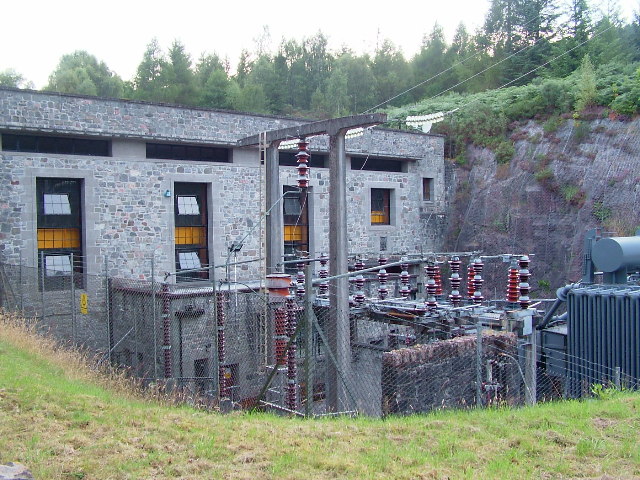
Image: © Paul Hookway Taken: 21 Aug 2005
Hydroelectric Power Station at Invergarry. Water is piped down the hill from an intake on Loch Garry. Part of the Glenmorriston hydroelectric scheme constructed in the 1960's by the North of Scotland Hydro Electric Board.
Images are licensed for reuse under creativecommons.org/licenses/by-sa/2.0
Image Location
Latitude
57.071016
Longitude
-4.776101