Footpath Across Nature Reserve
Introduction
The photograph on this page of Footpath Across Nature Reserve by Nigel Mykura as part of the Geograph project.
The Geograph project started in 2005 with the aim of publishing, organising and preserving representative images for every square kilometre of Great Britain, Ireland and the Isle of Man.

There are currently over 7.5m images from over 14,400 individuals and you can help contribute to the project by visiting https://www.geograph.org.uk
Footpath Across Nature Reserve
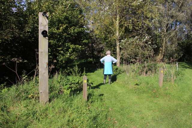
Image: © Nigel Mykura Taken: 7 Oct 2017
This is the southern end of the footpath across Lower Bruckland Nature Reserve. It has a movement activated CCTV (visible on top of the post) which allows the owners of the nature reserve (which normally has an entrance fee) to check that nobody is actually using the footpath to gain unpaid access to the reserve. there is also a loud speaker through which verbal warnings can be announced.
Images are licensed for reuse under creativecommons.org/licenses/by-sa/2.0
Image Location
Latitude
50.731837
Longitude
-3.035023