Musbury House
Introduction
The photograph on this page of Musbury House by Nigel Mykura as part of the Geograph project.
The Geograph project started in 2005 with the aim of publishing, organising and preserving representative images for every square kilometre of Great Britain, Ireland and the Isle of Man.

There are currently over 7.5m images from over 14,400 individuals and you can help contribute to the project by visiting https://www.geograph.org.uk
Musbury House
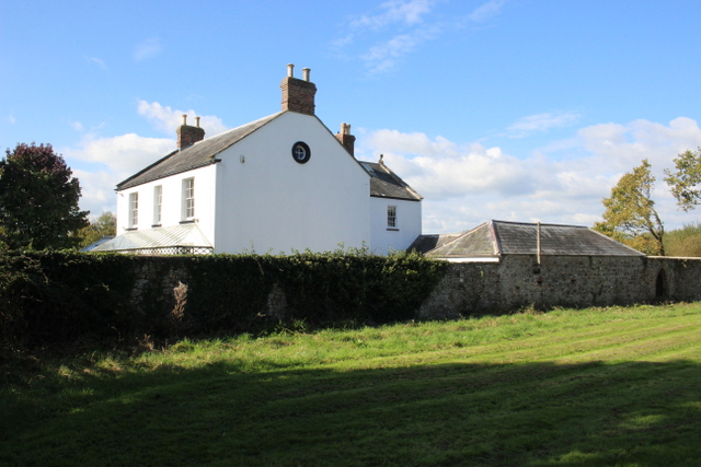
Image: © Nigel Mykura Taken: 7 Oct 2017
This is a Grade II listed building . Its listing is as follows:- "Early/mid C19 stuccoed house. Slate roof with stone coping to gable ends. Panelled corner pilasters. Two storeys and attic. Three bays. First floor sashes, without glazing bars. Ground floor panelled and glazed garden doors. Central doorway with panelled pilasters and round arch with panelled reveals, semi-circular fanlight and glazed and panelled door. Cast iron lattice verandah with glazed roof. Round attic windows in gable ends. Brick chimney stacks over gable ends." It is next door to Lower Bruckland Farm nature Reserve from where this photo was taken.
Images are licensed for reuse under creativecommons.org/licenses/by-sa/2.0
Image Location
Latitude
50.732428
Longitude
-3.039287