Former gate lodge of Levenford House
Introduction
The photograph on this page of Former gate lodge of Levenford House by Lairich Rig as part of the Geograph project.
The Geograph project started in 2005 with the aim of publishing, organising and preserving representative images for every square kilometre of Great Britain, Ireland and the Isle of Man.

There are currently over 7.5m images from over 14,400 individuals and you can help contribute to the project by visiting https://www.geograph.org.uk
Former gate lodge of Levenford House
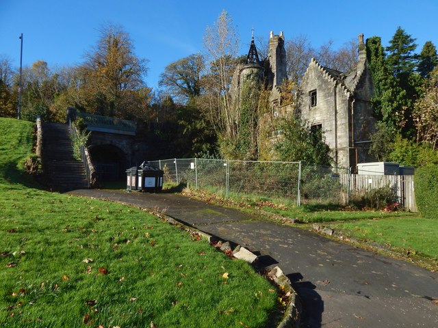
Image: © Lairich Rig Taken: 27 Oct 2017
Note the fire damage (to the turret in particular), when compared with an earlier view: Image Much of the rest of the damage to the roof is concealed from this angle. In the shadow to the right of the steps is a (blocked) tunnel to Image, occupying what was once Kirkton Quarry.
Images are licensed for reuse under creativecommons.org/licenses/by-sa/2.0
Image Location
Latitude
55.943547
Longitude
-4.577926