Whittington Castle (side view)
Introduction
The photograph on this page of Whittington Castle (side view) by Peter Craine as part of the Geograph project.
The Geograph project started in 2005 with the aim of publishing, organising and preserving representative images for every square kilometre of Great Britain, Ireland and the Isle of Man.

There are currently over 7.5m images from over 14,400 individuals and you can help contribute to the project by visiting https://www.geograph.org.uk
Whittington Castle (side view)
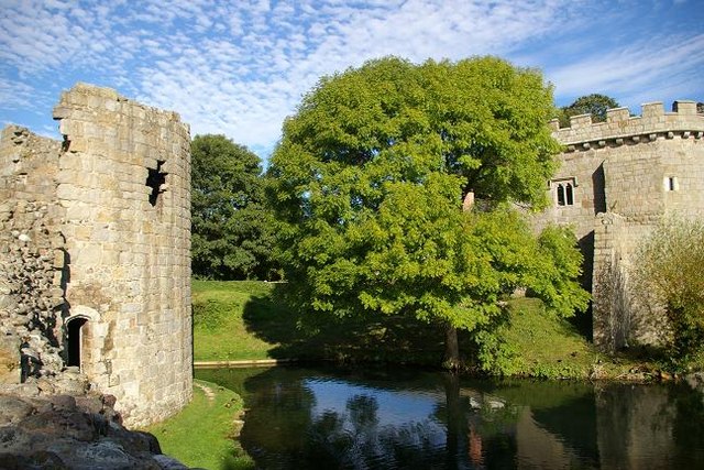
Image: © Peter Craine Taken: 15 Sep 2007
See also Image . The left hand side was originally the main part of the castle and the right hand side is the gate house. The two are joined by a bridge over the moat, which is at right angles to the main entrance. Further info can be obtained at http://www.btinternet.com/~whittington.castle/index.htm and http://www.castlewales.com/whittng.html
Images are licensed for reuse under creativecommons.org/licenses/by-sa/2.0
Image Location
Latitude
52.872951
Longitude
-3.002955