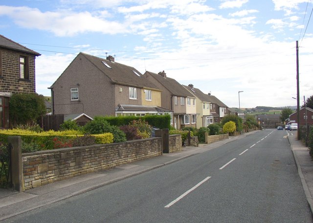
Moorside Road, Kirkheaton
Introduction
The photograph on this page of Moorside Road, Kirkheaton by Humphrey Bolton as part of the Geograph project.
The Geograph project started in 2005 with the aim of publishing, organising and preserving representative images for every square kilometre of Great Britain, Ireland and the Isle of Man.
There are currently over 7.5m images from over 14,400 individuals and you can help contribute to the project by visiting https://www.geograph.org.uk

Image: © Humphrey Bolton Taken: 14 Sep 2007
This is one of three straight roads that enter the village from the north. They might have been set out by an enclosure award. This one was called Workhouse Lane on the 1850 map, and the workhouse was half-way up. It was operated by the Huddersfield Union. Most of the houses have rendered walls, probably originally council houses, but the pair on the left are stone-faced.
Image Location


