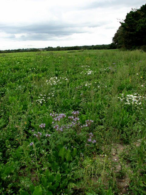
Heading east on the edge of a sugar beet field
Introduction
The photograph on this page of Heading east on the edge of a sugar beet field by Evelyn Simak as part of the Geograph project.
The Geograph project started in 2005 with the aim of publishing, organising and preserving representative images for every square kilometre of Great Britain, Ireland and the Isle of Man.
There are currently over 7.5m images from over 14,400 individuals and you can help contribute to the project by visiting https://www.geograph.org.uk

Image: © Evelyn Simak Taken: 17 Sep 2007
The blue flowering plant in the foreground is Lacy Phacelia (Latin name: Phacelia tanacetifolia). It is native to the arid southwest region of the USA and Mexico, but has been introduced to Europe, where it is extensively used both as a cover crop and as bee forage. In agriculture, phacelia is often used as so-called green manure crop. Green manure crops are sown and allowed to grow until the land is needed again or until the plants have reached a certain growth stage. They are then cut down and ploughed into the soil. Left to decompose, they release vital plant nutrients back into the soil, hence fertilizing it. Phacelia is also used as an intercrop with corn and sugar beet or as an undercrop in orchards. For a more detailed view see > Image

