Construction of terraced houses, Central Avenue
Introduction
The photograph on this page of Construction of terraced houses, Central Avenue by M J Roscoe as part of the Geograph project.
The Geograph project started in 2005 with the aim of publishing, organising and preserving representative images for every square kilometre of Great Britain, Ireland and the Isle of Man.

There are currently over 7.5m images from over 14,400 individuals and you can help contribute to the project by visiting https://www.geograph.org.uk
Construction of terraced houses, Central Avenue
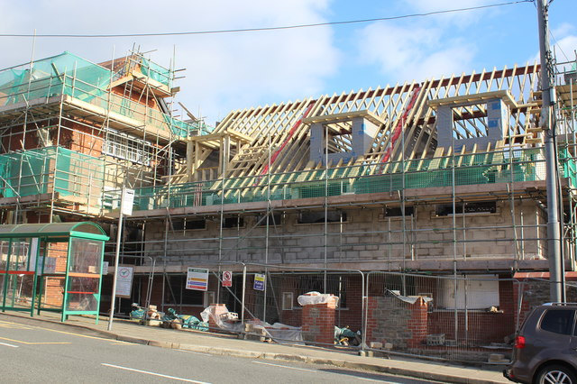
Image: © M J Roscoe Taken: 29 Oct 2017
A row of three houses in the yard of the former Oakdale Public House (left) for an earlier stage of construction see Image; the rear of the houses is shown in Image The former pub, a Grade II listed building, is being renovated and converted to apartments by a housing association. Use the bus stop to catch the 5 bus to Blackwood.
Images are licensed for reuse under creativecommons.org/licenses/by-sa/2.0
Image Location
Latitude
51.678084
Longitude
-3.178672