Former "Queen's Head" public house, Maryport - October 2017 (1)
Introduction
The photograph on this page of Former "Queen's Head" public house, Maryport - October 2017 (1) by The Carlisle Kid as part of the Geograph project.
The Geograph project started in 2005 with the aim of publishing, organising and preserving representative images for every square kilometre of Great Britain, Ireland and the Isle of Man.

There are currently over 7.5m images from over 14,400 individuals and you can help contribute to the project by visiting https://www.geograph.org.uk
Former "Queen's Head" public house, Maryport - October 2017 (1)
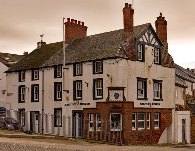
Image: © The Carlisle Kid Taken: 27 Oct 2017
Believed to be late 18th Century, the "Queen's Head" was acquired by the State Management Scheme in November 1918. Date of closure has not been found, but it is still shown as a public house on the 1970 OS Map. Now "Maryport Maritime Museum", to whom all queries should be addressed through their web site at: http://www.maryportmaritimemuseum.com/ See also: Image] and Image] .
Images are licensed for reuse under creativecommons.org/licenses/by-sa/2.0
Image Location
Latitude
54.714471
Longitude
-3.50071