Former "Senhouse Arms", Maryport - October 2017
Introduction
The photograph on this page of Former "Senhouse Arms", Maryport - October 2017 by The Carlisle Kid as part of the Geograph project.
The Geograph project started in 2005 with the aim of publishing, organising and preserving representative images for every square kilometre of Great Britain, Ireland and the Isle of Man.

There are currently over 7.5m images from over 14,400 individuals and you can help contribute to the project by visiting https://www.geograph.org.uk
Former "Senhouse Arms", Maryport - October 2017
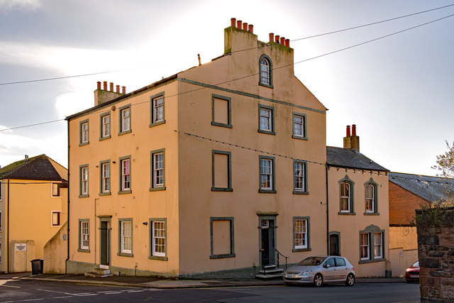
Image: © The Carlisle Kid Taken: 27 Oct 2017
First appears in the 1811 "Cumberland Guide & Directory" and is shown as an Inn on the 1866 OS Map. The Senhouse Arms was acquired by the State Management Scheme in November 1918 and sold to Greenall Whitley on 23 May 1973, the sale including a builders yard at 133-137 Crosby Street. Date of closure has not been ascertained. Building is Grade II listed. Private dwelling with no public access.
Images are licensed for reuse under creativecommons.org/licenses/by-sa/2.0
Image Location
Latitude
54.716047
Longitude
-3.496887