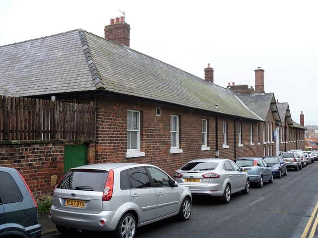
St Hilda's Hospital
Introduction
The photograph on this page of St Hilda's Hospital by Michael Dibb as part of the Geograph project.
The Geograph project started in 2005 with the aim of publishing, organising and preserving representative images for every square kilometre of Great Britain, Ireland and the Isle of Man.
There are currently over 7.5m images from over 14,400 individuals and you can help contribute to the project by visiting https://www.geograph.org.uk

Image: © Michael Dibb Taken: 17 Sep 2017
The history of this building is varied. From https://historicengland.org.uk/services-skills/education/educational-images/st-hildas-hospital-whitby-7208 "This building was originally the Whitby Workhouse. It was also known as the Ropery and later Whitby Union Workhouse. It was built between 1793 and 1794. It replaced an earlier parish workhouse of 1726-7 on Church Street. In 1837 it became a Union workhouse when it was taken over by the newly created Whitby Poor Law Union. It was enlarged in 1860 to designs by J B and W Atkinson and the additions, including an infirmary, made the building into a U-shape. In 1930, it became a Public Assistance Institution. In 1948, it became part of the National Health Service and was renamed St Hilda's Hospital." The hospital closed in 1978 on the opening of Whitby Hospital. The buildings were converted to small business units and is now known as St Hilda's Business Centre. Listed, grade II, with details at: https://www.historicengland.org.uk/listing/the-list/list-entry/1253831

