Hatton Grange, Worcester
Introduction
The photograph on this page of Hatton Grange, Worcester by Chris Allen as part of the Geograph project.
The Geograph project started in 2005 with the aim of publishing, organising and preserving representative images for every square kilometre of Great Britain, Ireland and the Isle of Man.

There are currently over 7.5m images from over 14,400 individuals and you can help contribute to the project by visiting https://www.geograph.org.uk
Hatton Grange, Worcester
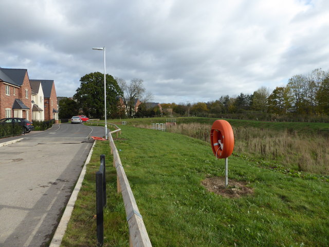
Image: © Chris Allen Taken: 22 Oct 2017
A new Persimmon Homes development. This is Honywood Place. The lifebelt is a little incongruous. This was a flat field before the houses were built to the left. There is now a dry pond that appears to receive the storm drains from the estate. There is a possible pumping station at one end that adjoins a substation. Perhaps I need to take another look after torrential rain.
Images are licensed for reuse under creativecommons.org/licenses/by-sa/2.0
Image Location
Latitude
52.181592
Longitude
-2.180578