Cowley House, 2000
Introduction
The photograph on this page of Cowley House, 2000 by Derek Harper as part of the Geograph project.
The Geograph project started in 2005 with the aim of publishing, organising and preserving representative images for every square kilometre of Great Britain, Ireland and the Isle of Man.

There are currently over 7.5m images from over 14,400 individuals and you can help contribute to the project by visiting https://www.geograph.org.uk
Cowley House, 2000
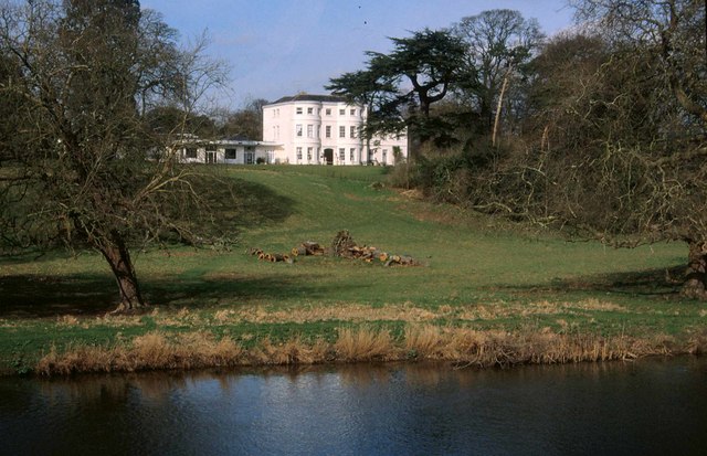
Image: © Derek Harper Taken: Unknown
Listed as Cowley House https://www.historicengland.org.uk/listing/the-list/list-entry/1164175 , mapped as Cowley Place. Virtually identical to the views at http://www.geograph.org.uk/search.php?i=78323945 . This is taken from Cowley Bridge and, more serious than any debate about the name of the house, the identity of the river in view is in doubt. A glance at the map would suggest that it is the River Exe, just downstream from its confluence with the River Creedy, and this is backed up by the listed building description for the bridge : "road bridge across the River Exe", but detailed OS maps identify it as the River Creedy.
Images are licensed for reuse under creativecommons.org/licenses/by-sa/2.0
Image Location
Latitude
50.750481
Longitude
-3.551284