High and Low Lights
Introduction
The photograph on this page of High and Low Lights by Ken Brown as part of the Geograph project.
The Geograph project started in 2005 with the aim of publishing, organising and preserving representative images for every square kilometre of Great Britain, Ireland and the Isle of Man.

There are currently over 7.5m images from over 14,400 individuals and you can help contribute to the project by visiting https://www.geograph.org.uk
High and Low Lights
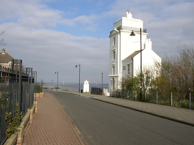
Image: © Ken Brown Taken: 16 Apr 2005
The tall white tower in the foreground is the High Light. Mariners entering the piers line up the light with its twin Low Light down on the Fish Quay, this gives them a safe channel into the river.
Images are licensed for reuse under creativecommons.org/licenses/by-sa/2.0
Image Location


Leaflet Map data © OpenStreetMap
Latitude
55.008773
Longitude
-1.438178