Former Trinity Calvinistic Methodist Church, Tonypandy
Introduction
The photograph on this page of Former Trinity Calvinistic Methodist Church, Tonypandy by Jaggery as part of the Geograph project.
The Geograph project started in 2005 with the aim of publishing, organising and preserving representative images for every square kilometre of Great Britain, Ireland and the Isle of Man.

There are currently over 7.5m images from over 14,400 individuals and you can help contribute to the project by visiting https://www.geograph.org.uk
Former Trinity Calvinistic Methodist Church, Tonypandy
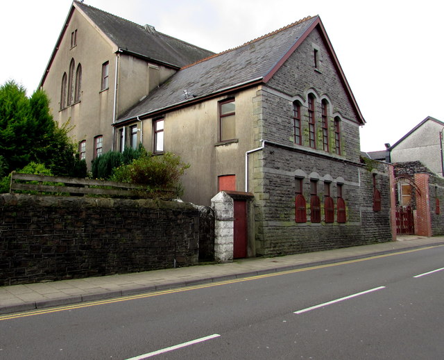
Image: © Jaggery Taken: 17 Oct 2017
The Dunraven Street side of the former church on the corner of Trinity Road, viewed in October 2017. The building dates from 1893. Some sources show Chapel instead of Church.
Images are licensed for reuse under creativecommons.org/licenses/by-sa/2.0
Image Location
Latitude
51.619463
Longitude
-3.451171