Site of the former Sandbach waterworks (2)
Introduction
The photograph on this page of Site of the former Sandbach waterworks (2) by Stephen Craven as part of the Geograph project.
The Geograph project started in 2005 with the aim of publishing, organising and preserving representative images for every square kilometre of Great Britain, Ireland and the Isle of Man.

There are currently over 7.5m images from over 14,400 individuals and you can help contribute to the project by visiting https://www.geograph.org.uk
Site of the former Sandbach waterworks (2)
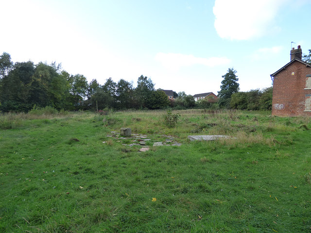
Image: © Stephen Craven Taken: 14 Oct 2017
Old maps show this area as a waterworks, opened in 1891. By 2014 it was derelict and planning permission (Ref 12/1650C) was granted for its demolition, removal of water treatment storage and settlement tanks, and construction of 12 two-storey detached dwellings. However, three years later development was yet to commence - developers seem at present to be focussing on areas closer to the motorway junction and railway station. The building at the right of the photo was the water board offices Image
Images are licensed for reuse under creativecommons.org/licenses/by-sa/2.0
Image Location
Latitude
53.146423
Longitude
-2.354897