War department boundary stone #2, Brook Lane
Introduction
The photograph on this page of War department boundary stone #2, Brook Lane by John S Turner as part of the Geograph project.
The Geograph project started in 2005 with the aim of publishing, organising and preserving representative images for every square kilometre of Great Britain, Ireland and the Isle of Man.

There are currently over 7.5m images from over 14,400 individuals and you can help contribute to the project by visiting https://www.geograph.org.uk
War department boundary stone #2, Brook Lane
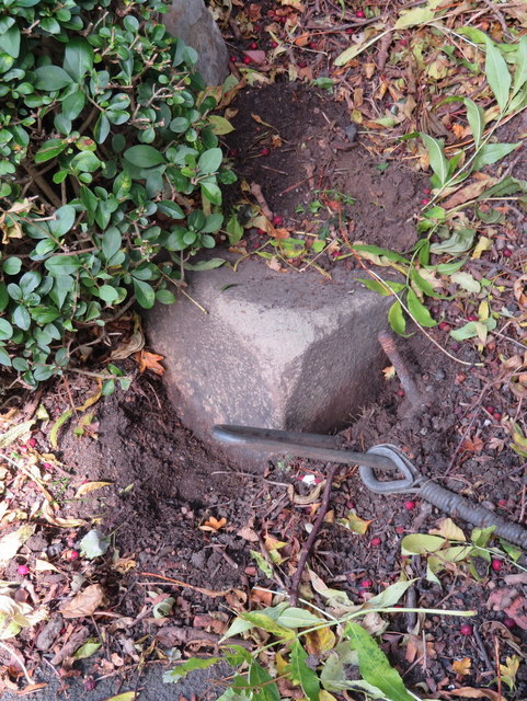
Image: © John S Turner Taken: 15 Oct 2017
This stone is half buried at the corner of Western Approach and Brook Lane. Although no inscription is visible it is in the correct location for the War Department stone #2 that is marked on the 1936 O.S. maps. Several other WD stones are shown surrounding the area of the Western Approach properties, which were probably associated with Western Command, but the other stones are either missing or inaccessible. See also Image Milestone Society National ID: CH_WDCHES02em.
Images are licensed for reuse under creativecommons.org/licenses/by-sa/2.0
Image Location
Latitude
53.203286
Longitude
-2.8816