Lilford House flats seen across Coldharbour Lane, Camberwell, south London
Introduction
The photograph on this page of Lilford House flats seen across Coldharbour Lane, Camberwell, south London by Robin Stott as part of the Geograph project.
The Geograph project started in 2005 with the aim of publishing, organising and preserving representative images for every square kilometre of Great Britain, Ireland and the Isle of Man.

There are currently over 7.5m images from over 14,400 individuals and you can help contribute to the project by visiting https://www.geograph.org.uk
Lilford House flats seen across Coldharbour Lane, Camberwell, south London
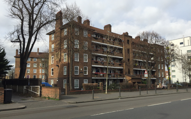
Image: © Robin Stott Taken: 20 Feb 2017
Here we are in the London Borough of Lambeth. We see two wings of Lilford House. The central third side faces Lilford Road, the turning before the white block. Lilford House and its neighbour Brigstock House are shown in outline on an OS map of 1938; built on a map of 1949-54.
Images are licensed for reuse under creativecommons.org/licenses/by-sa/2.0
Image Location
Latitude
51.46818
Longitude
-0.099152