Tresmeer: old station
Introduction
The photograph on this page of Tresmeer: old station by Martin Bodman as part of the Geograph project.
The Geograph project started in 2005 with the aim of publishing, organising and preserving representative images for every square kilometre of Great Britain, Ireland and the Isle of Man.

There are currently over 7.5m images from over 14,400 individuals and you can help contribute to the project by visiting https://www.geograph.org.uk
Tresmeer: old station
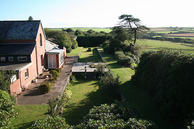
Image: © Martin Bodman Taken: 15 Sep 2007
The platforms and station house survive at the hamlet of Splatt, as well as one running in board or station sign – all now part of a private residence. Seen from the old railway overbridge. A signalbox used to stand on the far platform. The North Cornwall reached here in 1892; Tresmeer was a temporary terminus until the line was extended to Camelford in October 1893, and was a centre for trade in cattle, rabbits and slate. Closure came in October 1966
Images are licensed for reuse under creativecommons.org/licenses/by-sa/2.0
Image Location
Latitude
50.669307
Longitude
-4.517466