No 49 Ulsterville Avenue, Belfast (October 2017)
Introduction
The photograph on this page of No 49 Ulsterville Avenue, Belfast (October 2017) by Albert Bridge as part of the Geograph project.
The Geograph project started in 2005 with the aim of publishing, organising and preserving representative images for every square kilometre of Great Britain, Ireland and the Isle of Man.

There are currently over 7.5m images from over 14,400 individuals and you can help contribute to the project by visiting https://www.geograph.org.uk
No 49 Ulsterville Avenue, Belfast (October 2017)
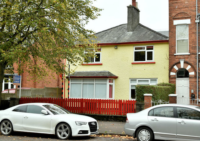
Image: © Albert Bridge Taken: 15 Oct 2017
A detached house, on the northern side of Ulsterville Avenue, built in the “inter-war” period and recently used as a day nursery. Now the subject of the following application for planning permission (1 September 2017) “LA04/2017/2109/F Demolition of building and construction of residential development comprising 6 one bedroom and 2 two bedroom apartments and ancillary site works 49 Ulsterville Avenue Lisburn Road Belfast BT9 7AT”. This photograph appears as a matter of neutral record only. I have no connection with the property and express no opinion about the application.
Images are licensed for reuse under creativecommons.org/licenses/by-sa/2.0
Image Location
Latitude
54.585666
Longitude
-5.947372