Towards Barton Street
Introduction
The photograph on this page of Towards Barton Street by David Stowell as part of the Geograph project.
The Geograph project started in 2005 with the aim of publishing, organising and preserving representative images for every square kilometre of Great Britain, Ireland and the Isle of Man.

There are currently over 7.5m images from over 14,400 individuals and you can help contribute to the project by visiting https://www.geograph.org.uk
Towards Barton Street
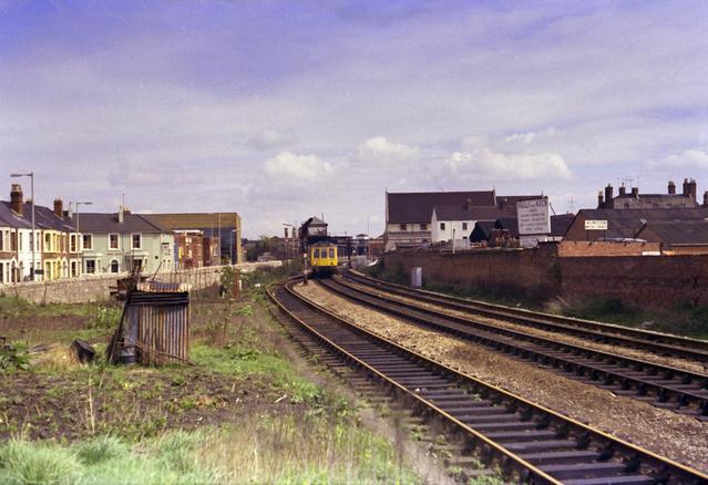
Image: © David Stowell Taken: Unknown
Taken from the same spot as Image but looking towards Barton Street level crossing and Gloucester Eastgate station some months before the line closed. The left hand track is the start of the High Orchard branch. In the distance, over the roof of the DMU can be seen Barton Street Junction Signal box. Due to the restricted location and the need to have good visibility to control the level crossing the signal box was mounted on a gantry over the tracks. Gloucester Eastgate Station was almost immediately beyond. Today this area is buried under retail shopping developments.
Images are licensed for reuse under creativecommons.org/licenses/by-sa/2.0
Image Location
Latitude
51.860337
Longitude
-2.241001