65-77 Acomb Road
Introduction
The photograph on this page of 65-77 Acomb Road by Ian Capper as part of the Geograph project.
The Geograph project started in 2005 with the aim of publishing, organising and preserving representative images for every square kilometre of Great Britain, Ireland and the Isle of Man.

There are currently over 7.5m images from over 14,400 individuals and you can help contribute to the project by visiting https://www.geograph.org.uk
65-77 Acomb Road
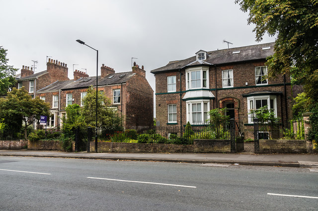
Image: © Ian Capper Taken: 19 Jul 2017
65-73 Acomb Road (of which 69-73 is the terrace to the left of centre of the photo and 67 is the large house on the far left; 65 is not visible in this photo), were built in 1828-9 and were named Severus Place in 1853. 75-77 Acomb Road is the semi-detached villa on the right.
Images are licensed for reuse under creativecommons.org/licenses/by-sa/2.0
Image Location


Leaflet Map data © OpenStreetMap
Latitude
53.95533
Longitude
-1.111069