St. Enda's GAA ground, Omagh
Introduction
The photograph on this page of St. Enda's GAA ground, Omagh by Gordon Dunn as part of the Geograph project.
The Geograph project started in 2005 with the aim of publishing, organising and preserving representative images for every square kilometre of Great Britain, Ireland and the Isle of Man.

There are currently over 7.5m images from over 14,400 individuals and you can help contribute to the project by visiting https://www.geograph.org.uk
St. Enda's GAA ground, Omagh
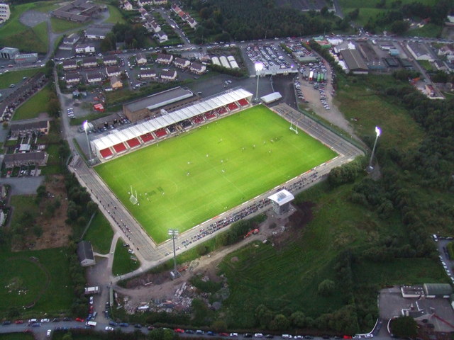
Image: © Gordon Dunn Taken: 7 Sep 2007
St. Enda's GAA ground Gortin Road, Omagh. This picture was taken during a floodlit game close to sunset. There is quite a large crowd of spectators on the grandstands.
Images are licensed for reuse under creativecommons.org/licenses/by-sa/2.0
Image Location


Leaflet Map data © OpenStreetMap
Latitude
54.614071
Longitude
-7.295734