Another view of the Brandsbutt Stone
Introduction
The photograph on this page of Another view of the Brandsbutt Stone by Bill Harrison as part of the Geograph project.
The Geograph project started in 2005 with the aim of publishing, organising and preserving representative images for every square kilometre of Great Britain, Ireland and the Isle of Man.

There are currently over 7.5m images from over 14,400 individuals and you can help contribute to the project by visiting https://www.geograph.org.uk
Another view of the Brandsbutt Stone
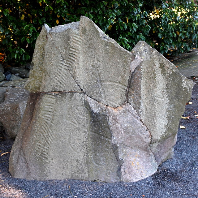
Image: © Bill Harrison Taken: 30 Sep 2017
This fine symbol stone was blown up in the 19th Century and the fragments used to construct a dyke but most of it was later reassembled with cement infills. Until recently it was in open farmland, but is now surrounded by suburban housing. It is decorated with Pictish crescent and V-rod and a serpent and Z-rod symbols as well as Ogam characters. Canmore reference 18894: https://canmore.org.uk/site/18894/brandsbutt-inverurie-symbol-stone . For more, see Allen and Anderson, Early Christian Monuments of Scotland, vol. 3, p. 506, available as a download from archive.org
Images are licensed for reuse under creativecommons.org/licenses/by-sa/2.0
Image Location
Latitude
57.291574
Longitude
-2.399993