Belan Place house
Introduction
The photograph on this page of Belan Place house by Richard Law as part of the Geograph project.
The Geograph project started in 2005 with the aim of publishing, organising and preserving representative images for every square kilometre of Great Britain, Ireland and the Isle of Man.

There are currently over 7.5m images from over 14,400 individuals and you can help contribute to the project by visiting https://www.geograph.org.uk
Belan Place house
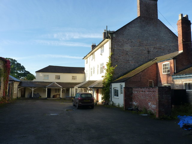
Image: © Richard Law Taken: 19 Sep 2017
The rear of the main house at Belan Place, which attracted a Grade II listing https://www.britishlistedbuildings.co.uk/300015732-belan-place-ruabon#.Wdxp8vlSyM8 in 1995. It's believed to be the former dower house of the estate (i.e. built for the use of the widow of the main landowner) and to date from the 18th century. The better view, and front of the house, is the other side to that seen here, but unfortunately the morning light made photographing that rather difficult. It's now a private dwelling, and no longer part of the estate.
Images are licensed for reuse under creativecommons.org/licenses/by-sa/2.0
Image Location


Leaflet Map data © OpenStreetMap
Latitude
52.970809
Longitude
-3.028599