Lower Ashton, 2000
Introduction
The photograph on this page of Lower Ashton, 2000 by Derek Harper as part of the Geograph project.
The Geograph project started in 2005 with the aim of publishing, organising and preserving representative images for every square kilometre of Great Britain, Ireland and the Isle of Man.

There are currently over 7.5m images from over 14,400 individuals and you can help contribute to the project by visiting https://www.geograph.org.uk
Lower Ashton, 2000
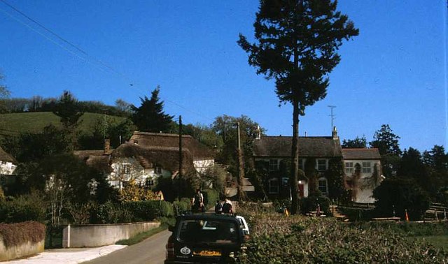
Image: © Derek Harper Taken: 1 May 2000
The Manor Inn is on the right. The nearer of the two thatched cottages left of centre is Forge Cottage, which is "on a corner site in the centre of Lower Ashton and makes a crucial contribution to a group including Spara Bridge, the Post Office and Blatchford Farmhouse" https://www.historicengland.org.uk/listing/the-list/list-entry/1097821 . Rising behind it is the post office (former, that is) https://www.historicengland.org.uk/listing/the-list/list-entry/1097820 . And in the foreground is our old Volvo.
Images are licensed for reuse under creativecommons.org/licenses/by-sa/2.0
Image Location
Latitude
50.646081
Longitude
-3.635822