Demolition of West Bridgend Community Centre
Introduction
The photograph on this page of Demolition of West Bridgend Community Centre by Lairich Rig as part of the Geograph project.
The Geograph project started in 2005 with the aim of publishing, organising and preserving representative images for every square kilometre of Great Britain, Ireland and the Isle of Man.

There are currently over 7.5m images from over 14,400 individuals and you can help contribute to the project by visiting https://www.geograph.org.uk
Demolition of West Bridgend Community Centre
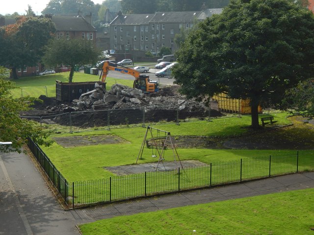
Image: © Lairich Rig Taken: 26 Sep 2017
The view is from Image For more context, see Image, taken a day earlier. The community centre had been deemed unsafe, and was being demolished. The picture was taken on a Tuesday; for a view from a different angle on the same day, see Image By the weekend, everything above ground level had been cleared away: Image For pictures showing or including the community centre before it was demolished, see Image / Image / Image / Image It was originally intended that a new community centre be built in the same place, but by early 2019 the site was grassed over.
Images are licensed for reuse under creativecommons.org/licenses/by-sa/2.0
Image Location
Latitude
55.945545
Longitude
-4.576938