Beside the West Bridgend high flats
Introduction
The photograph on this page of Beside the West Bridgend high flats by Lairich Rig as part of the Geograph project.
The Geograph project started in 2005 with the aim of publishing, organising and preserving representative images for every square kilometre of Great Britain, Ireland and the Isle of Man.

There are currently over 7.5m images from over 14,400 individuals and you can help contribute to the project by visiting https://www.geograph.org.uk
Beside the West Bridgend high flats
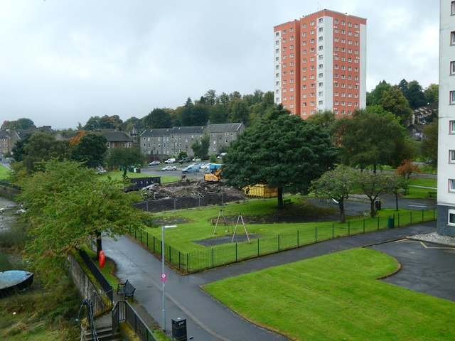
Image: © Lairich Rig Taken: 25 Sep 2017
The view is from Image For the high flats, see Image In the left foreground is the footpath / cycle path, part of NCN Route 7 (Image). Just beyond the play area was West Bridgend Community Centre, which was being demolished when this picture was taken: for closer views, see Image and Image
Images are licensed for reuse under creativecommons.org/licenses/by-sa/2.0
Image Location


Leaflet Map data © OpenStreetMap
Latitude
55.945635
Longitude
-4.576944