Barn, Higher Staplehill
Introduction
The photograph on this page of Barn, Higher Staplehill by Derek Harper as part of the Geograph project.
The Geograph project started in 2005 with the aim of publishing, organising and preserving representative images for every square kilometre of Great Britain, Ireland and the Isle of Man.

There are currently over 7.5m images from over 14,400 individuals and you can help contribute to the project by visiting https://www.geograph.org.uk
Barn, Higher Staplehill
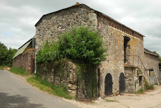
Image: © Derek Harper Taken: 7 Jul 2017
A slightly more complete view of the listed barn https://www.historicengland.org.uk/listing/the-list/list-entry/1256821 shown in Image "Just below the eaves on the east, farmyard front is a pigeon loft formed by a long horizontal opening with timber lintel and sill filled at narrow intervals with 3 courses of bricks in blocks, the spaces are access for the birds. ... To the ground floor are 3 semicircular openings with finely-cut Devon limestone voussoirs". I hope that buddleia isn't doing irreparable damage.
Images are licensed for reuse under creativecommons.org/licenses/by-sa/2.0
Image Location
Latitude
50.551134
Longitude
-3.659494