The Bogside, St Eugene's Cathedral
Introduction
The photograph on this page of The Bogside, St Eugene's Cathedral by David Dixon as part of the Geograph project.
The Geograph project started in 2005 with the aim of publishing, organising and preserving representative images for every square kilometre of Great Britain, Ireland and the Isle of Man.

There are currently over 7.5m images from over 14,400 individuals and you can help contribute to the project by visiting https://www.geograph.org.uk
The Bogside, St Eugene's Cathedral
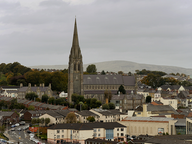
Image: © David Dixon Taken: 26 Sep 2017
The Bogside is a neighbourhood outside the city walls of Derry (from where this photograph was taken). The area now known as the Bogside was originally underwater. The Foyle flowed round the island of Derry, and was first settled as the river diverted. It dried out into marshland: hence the name Bogside. The first recorded settlers in the Bogside were listed in a 1622 survey. The influx of migrants throughout the 18th century created a significant Catholic population in Derry. Because Catholics were forbidden from living within the walls most settled in the Bogside. The steady growth of the Catholic population was reflected in the construction of the city’s first Catholic church, Long Tower (1784), and St Eugene’s Cathedral (1851). More information: http://www.museumoffreederry.org/content/bogside (The Museum of Free Derry). https://en.wikipedia.org/wiki/St_Eugene%27s_Cathedral (Wikipedia page about St Eugene's Cathedral)
Images are licensed for reuse under creativecommons.org/licenses/by-sa/2.0
Image Location
Latitude
54.99988
Longitude
-7.328523