113-114, High Street
Introduction
The photograph on this page of 113-114, High Street by John Baker as part of the Geograph project.
The Geograph project started in 2005 with the aim of publishing, organising and preserving representative images for every square kilometre of Great Britain, Ireland and the Isle of Man.

There are currently over 7.5m images from over 14,400 individuals and you can help contribute to the project by visiting https://www.geograph.org.uk
113-114, High Street
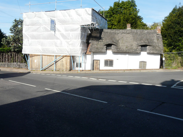
Image: © John Baker Taken: 10 Sep 2017
Planning permission has been granted by Dover District Council under application number DOV/ 17/00101 for the “demolition/removal of chimney stack/fireplace and rebuild to full height” and DOV/17/00102 for the “demolition/removal of chimney stack/fireplace as unstable following vehicle impact and rebuild to full height”. Number 113 is the part of the semi-detached house encased in scaffolding and plastic sheeting.
Images are licensed for reuse under creativecommons.org/licenses/by-sa/2.0
Image Location
Latitude
51.276641
Longitude
1.21674