
Pit head buildings, Dolaucothi Gold Mines
Introduction
The photograph on this page of Pit head buildings, Dolaucothi Gold Mines by M J Roscoe as part of the Geograph project.
The Geograph project started in 2005 with the aim of publishing, organising and preserving representative images for every square kilometre of Great Britain, Ireland and the Isle of Man.

There are currently over 7.5m images from over 14,400 individuals and you can help contribute to the project by visiting https://www.geograph.org.uk
Pit head buildings, Dolaucothi Gold Mines
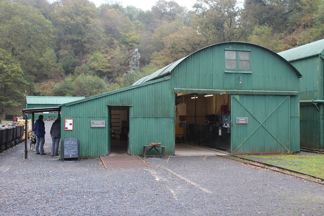
Image: © M J Roscoe Taken: 24 Sep 2017
The lean-to building on the left is the Kitting Up Shed for those undertaking the underground tour. The bilingual notice on the blackboard asks people to book tours at the window (where two people are standing). The round roofed building is the workshop with a railway line to the mine shaft. The buildings are not the originals, but are similar to those in use here in the 1930s. There is a line of drams on the extreme left.
Images are licensed for reuse under creativecommons.org/licenses/by-sa/2.0
Image Location

Latitude
52.044486
Longitude
-3.950195