Paisley from the air
Introduction
The photograph on this page of Paisley from the air by Thomas Nugent as part of the Geograph project.
The Geograph project started in 2005 with the aim of publishing, organising and preserving representative images for every square kilometre of Great Britain, Ireland and the Isle of Man.

There are currently over 7.5m images from over 14,400 individuals and you can help contribute to the project by visiting https://www.geograph.org.uk
Paisley from the air
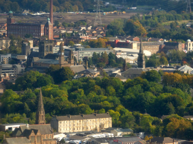
Image: © Thomas Nugent Taken: 25 Sep 2017
St James Church of Scotland on Underwood Road and Kerr Street are in the foreground. The wooded north slope of Oakshaw Hill dominates the centre, with Paisley Town Hall, Paisley Abbey, Mile End mill and the Embroidery Mill all visible beyond. Three of the churches on Oakshaw Hill can also be seen.
Images are licensed for reuse under creativecommons.org/licenses/by-sa/2.0
Image Location
Latitude
55.848603
Longitude
-4.433755