Construction on the former St Mary's Allotments
Introduction
The photograph on this page of Construction on the former St Mary's Allotments by Mat Fascione as part of the Geograph project.
The Geograph project started in 2005 with the aim of publishing, organising and preserving representative images for every square kilometre of Great Britain, Ireland and the Isle of Man.

There are currently over 7.5m images from over 14,400 individuals and you can help contribute to the project by visiting https://www.geograph.org.uk
Construction on the former St Mary's Allotments
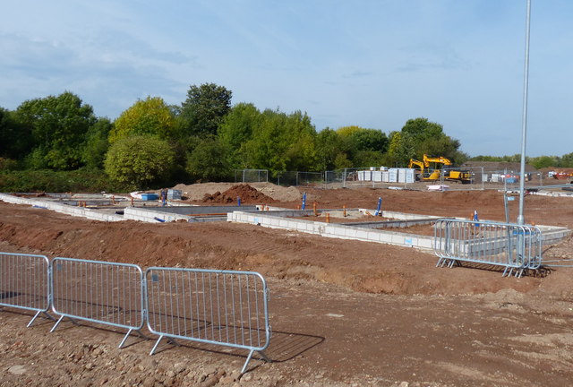
Image: © Mat Fascione Taken: 24 Sep 2017
The St Mary's Allotments site have been derelict since the early 1990s. The site has been cleared in preparation for the construction of over 100 homes and park land. These are the foundations of the first homes.
Images are licensed for reuse under creativecommons.org/licenses/by-sa/2.0
Image Location
Latitude
52.614261
Longitude
-1.138762