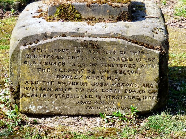
Base of former Stretford Cross
Introduction
The photograph on this page of Base of former Stretford Cross by Gerald England as part of the Geograph project.
The Geograph project started in 2005 with the aim of publishing, organising and preserving representative images for every square kilometre of Great Britain, Ireland and the Isle of Man.
There are currently over 7.5m images from over 14,400 individuals and you can help contribute to the project by visiting https://www.geograph.org.uk

Image: © Gerald England Taken: 8 Apr 2017
This cross base, later used as a sundial base is said to be of Medieval origin. The roughly hewn stone is cubic shape with remains of sundial shaft at top and one side refaced and inscribed in 1863 to commemorate its removal from the junction of Chester Road and King Street to the old churchyard Image The text reads: THIS STONE, THE REMAINS OF THE STRETFORD CROSS, WAS PLACED IN THE OLD CHURCH YARD OF STRETFORD WITH THE CONSENT OF THE RECTOR, DUDLEY HART M.A. AND THE WARDENS JOHN WREAKS AND WILLIAM KAYE BY THE LOCAL BOARD OF HEALTH ESTABLISHED IN STRETFORD 1868 JOHN WRIGHT FNRST CHAIRMAN It is Grade II listed http://www.britishlistedbuildings.co.uk/101162750-former-cross-base-in-st-matthews-churchyard-stretford-ward

