Hayfield village centre from the northeast
Introduction
The photograph on this page of Hayfield village centre from the northeast by Dave Dunford as part of the Geograph project.
The Geograph project started in 2005 with the aim of publishing, organising and preserving representative images for every square kilometre of Great Britain, Ireland and the Isle of Man.

There are currently over 7.5m images from over 14,400 individuals and you can help contribute to the project by visiting https://www.geograph.org.uk
Hayfield village centre from the northeast
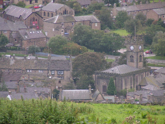
Image: © Dave Dunford Taken: 11 Sep 2004
Looking WSW from approx. SK041871 (near Twenty Trees - see Image), showing the parish church of St. Matthew prominently to the right of centre, the Bull Inn just left of centre (with the black-painted window surrounds) and St. John's Methodist church (top left). The site of the former railway station and sidings (now a car park and visitor centre) is to the right beyond the main road, behind the church in this picture.
Images are licensed for reuse under creativecommons.org/licenses/by-sa/2.0
Image Location


Leaflet Map data © OpenStreetMap
Latitude
53.378941
Longitude
-1.947348