Historic Wilsontown
Introduction
The photograph on this page of Historic Wilsontown by M J Richardson as part of the Geograph project.
The Geograph project started in 2005 with the aim of publishing, organising and preserving representative images for every square kilometre of Great Britain, Ireland and the Isle of Man.

There are currently over 7.5m images from over 14,400 individuals and you can help contribute to the project by visiting https://www.geograph.org.uk
Historic Wilsontown
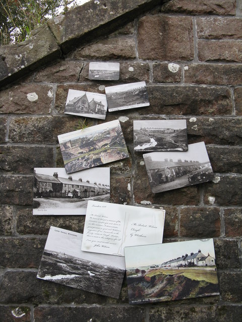
Image: © M J Richardson Taken: 15 Sep 2017
A display of photographs of the old village of Wilsontown when it was a flourishing ironworks in the 19thC. On the buttress of the bridge that carried the railway over what is now the entrance to the site.
Images are licensed for reuse under creativecommons.org/licenses/by-sa/2.0
Image Location
Latitude
55.775388
Longitude
-3.673399