Information Board, 'The Braes', Buckhaven
Introduction
The photograph on this page of Information Board, 'The Braes', Buckhaven by Bill Kasman as part of the Geograph project.
The Geograph project started in 2005 with the aim of publishing, organising and preserving representative images for every square kilometre of Great Britain, Ireland and the Isle of Man.

There are currently over 7.5m images from over 14,400 individuals and you can help contribute to the project by visiting https://www.geograph.org.uk
Information Board, 'The Braes', Buckhaven
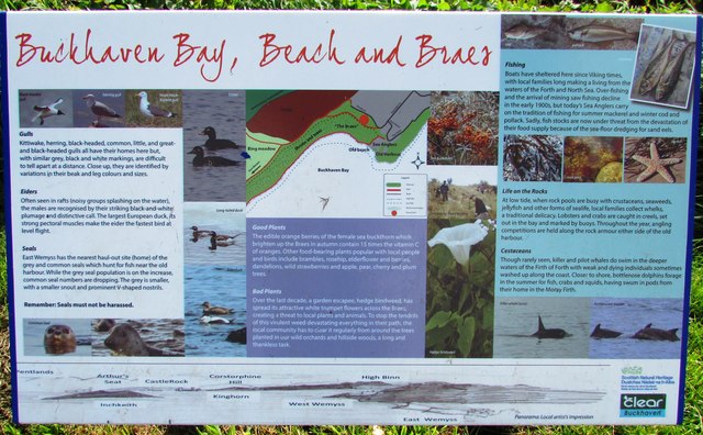
Image: © Bill Kasman Taken: 17 Sep 2017
This is one of several different information boards which can be found on the path which runs along the top of 'The Braes' above Buckhaven Bay. They all give interesting details of the heritage of Buckhaven and some of the wildlife which can be found in this area.
Images are licensed for reuse under creativecommons.org/licenses/by-sa/2.0
Image Location
Latitude
56.169281
Longitude
-3.040471