Westgate Grove
Introduction
The photograph on this page of Westgate Grove by Ian Taylor as part of the Geograph project.
The Geograph project started in 2005 with the aim of publishing, organising and preserving representative images for every square kilometre of Great Britain, Ireland and the Isle of Man.

There are currently over 7.5m images from over 14,400 individuals and you can help contribute to the project by visiting https://www.geograph.org.uk
Westgate Grove
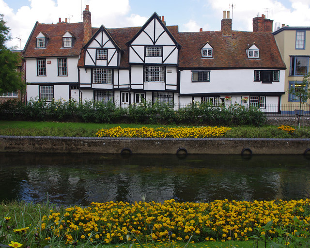
Image: © Ian Taylor Taken: 1 Sep 2017
Timber-frame buildings, seen from across one channel of the River Great Stour. Grade II listed buildings. See https://historicengland.org.uk/listing/the-list/list-entry/1242875 https://historicengland.org.uk/listing/the-list/list-entry/1242909 https://historicengland.org.uk/listing/the-list/list-entry/1242874 https://historicengland.org.uk/listing/the-list/list-entry/1242873
Images are licensed for reuse under creativecommons.org/licenses/by-sa/2.0
Image Location
Latitude
51.281444
Longitude
1.074942