1-11 and 13-19 High Street
Introduction
The photograph on this page of 1-11 and 13-19 High Street by Ian Capper as part of the Geograph project.
The Geograph project started in 2005 with the aim of publishing, organising and preserving representative images for every square kilometre of Great Britain, Ireland and the Isle of Man.

There are currently over 7.5m images from over 14,400 individuals and you can help contribute to the project by visiting https://www.geograph.org.uk
1-11 and 13-19 High Street
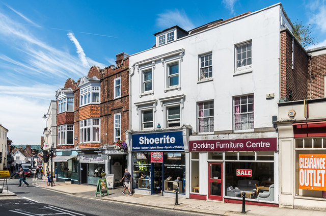
Image: © Ian Capper Taken: 11 Aug 2017
For closer view of 1-11 High Street, see Image 13-19 High Street, the white stuccoed building, whilst it appears to be a single structure, is in fact in two parts - 13-15 High Street, on the left, is early to mid 19th Century, whereas 17-19 High Street, on the right, is late 18th/early 19th Century. Both parts are grade II listed - see www.historicengland.org.uk/listing/the-list/list-entry/1028865 and www.historicengland.org.uk/listing/the-list/list-entry/1228133 respectively.
Images are licensed for reuse under creativecommons.org/licenses/by-sa/2.0
Image Location
Latitude
51.231635
Longitude
-0.332796