Chapel Lane, Barrowden
Introduction
The photograph on this page of Chapel Lane, Barrowden by Jo and Steve Turner as part of the Geograph project.
The Geograph project started in 2005 with the aim of publishing, organising and preserving representative images for every square kilometre of Great Britain, Ireland and the Isle of Man.

There are currently over 7.5m images from over 14,400 individuals and you can help contribute to the project by visiting https://www.geograph.org.uk
Chapel Lane, Barrowden
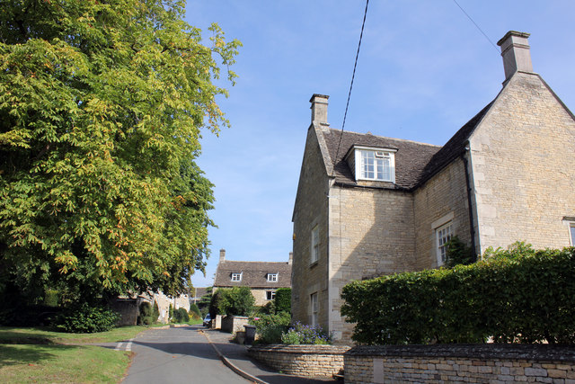
Image: © Jo and Steve Turner Taken: 28 Aug 2017
The first house, Cornerstone House, 2 Chapel Lane, is Grade II Listed late 17th century. In the distance also Grade II Listed is 8 Chapel Lane dated 1799 and formerly known as Smithy House.
Images are licensed for reuse under creativecommons.org/licenses/by-sa/2.0
Image Location
Latitude
52.590268
Longitude
-0.602346