Hawkhurst: Dunk's Almshouses and School
Introduction
The photograph on this page of Hawkhurst: Dunk's Almshouses and School by Stefan Czapski as part of the Geograph project.
The Geograph project started in 2005 with the aim of publishing, organising and preserving representative images for every square kilometre of Great Britain, Ireland and the Isle of Man.

There are currently over 7.5m images from over 14,400 individuals and you can help contribute to the project by visiting https://www.geograph.org.uk
Hawkhurst: Dunk's Almshouses and School
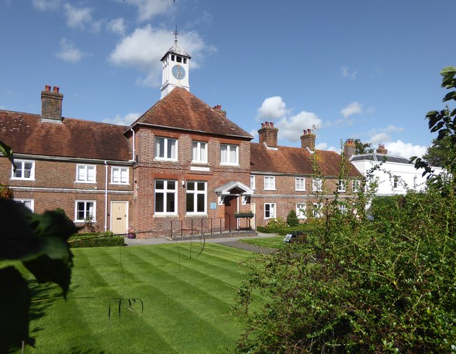
Image: © Stefan Czapski Taken: 9 Sep 2017
The school occupied the square central block, with ranges of almshouses on either side. A tablet on the school block reads: GIVEN BY Sr THOMAS DUNK Kt 1723 What is clear is that most of the 1723 details (including windows) have been lost - almshouses, after all, have to be kept in habitable condition. The Dunk's site is on the north side of the Rye road, opposite the unsightly disused church http://www.geograph.org.uk/photo/2516405 and (these days) Waitrose.
Images are licensed for reuse under creativecommons.org/licenses/by-sa/2.0
Image Location
Latitude
51.047458
Longitude
0.5122