Drumlin belt between the Mournes and the Slieve Croob range
Introduction
The photograph on this page of Drumlin belt between the Mournes and the Slieve Croob range by Eric Jones as part of the Geograph project.
The Geograph project started in 2005 with the aim of publishing, organising and preserving representative images for every square kilometre of Great Britain, Ireland and the Isle of Man.

There are currently over 7.5m images from over 14,400 individuals and you can help contribute to the project by visiting https://www.geograph.org.uk
Drumlin belt between the Mournes and the Slieve Croob range
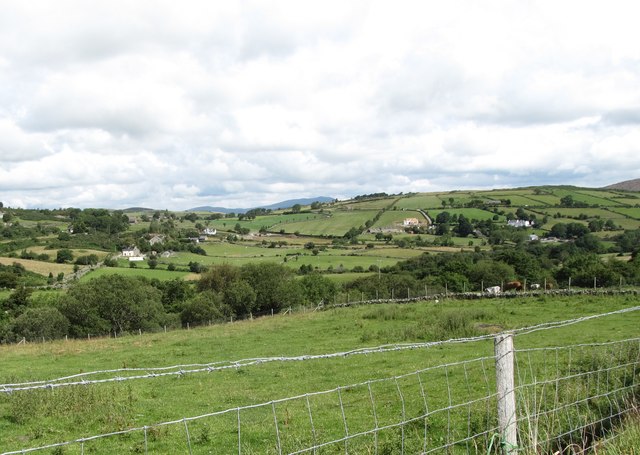
Image: © Eric Jones Taken: 22 Jul 2017
The drumlin dominated landscape was formed by the passage of massive ice sheets during the Quaternary period. The Quaternary Ice Age came to an end some 13,000 years ago revealing a landscape of rounded hills of glacial debris. Isostatic movements led to the rejuvenation of the rivers - including the Shimna in the foreground- which deeply incised themselves into the landscape. The hills in the background are members of the Slieve Croob range.
Images are licensed for reuse under creativecommons.org/licenses/by-sa/2.0
Image Location
Latitude
54.216617
Longitude
-5.993937