
Castleford Cemetery
Introduction
The photograph on this page of Castleford Cemetery by David Pickersgill as part of the Geograph project.
The Geograph project started in 2005 with the aim of publishing, organising and preserving representative images for every square kilometre of Great Britain, Ireland and the Isle of Man.

There are currently over 7.5m images from over 14,400 individuals and you can help contribute to the project by visiting https://www.geograph.org.uk
Castleford Cemetery
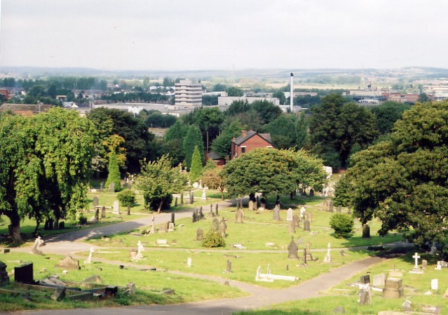
Image: © David Pickersgill Taken: 9 Sep 2007
The upper part of the cemetery, on the south side of Healdfield Road from http://www.geograph.org.uk/photo/68254. Back in the 19th century, those of a Church of England persuasion were buried in this side, while Catholics, Methodists and other religions were buried on the other side of the road! The office block and chimney behind the trees belong to the Nestlé factory on Wheldon Road, which makes Yorkie bars and After Eight mints.
Images are licensed for reuse under creativecommons.org/licenses/by-sa/2.0
Image Location

Latitude
53.726416
Longitude
-1.338854