Stokes Croft
Introduction
The photograph on this page of Stokes Croft by Derek Harper as part of the Geograph project.
The Geograph project started in 2005 with the aim of publishing, organising and preserving representative images for every square kilometre of Great Britain, Ireland and the Isle of Man.

There are currently over 7.5m images from over 14,400 individuals and you can help contribute to the project by visiting https://www.geograph.org.uk
Stokes Croft
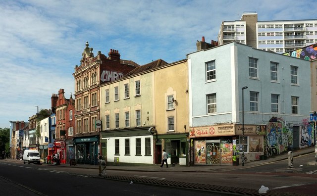
Image: © Derek Harper Taken: 26 Jun 2017
Buildings on the west side of the A38 between the junctions with Jamaica Street and Nine Tree Hill (right). The second and third premises along from the latter form the former Swan Inn "Inn, now club. c1711, C19 front" https://www.historicengland.org.uk/listing/the-list/list-entry/1282098 .
Images are licensed for reuse under creativecommons.org/licenses/by-sa/2.0
Image Location
Latitude
51.463845
Longitude
-2.589995