Canal near Four Ashes in Staffordshire
Introduction
The photograph on this page of Canal near Four Ashes in Staffordshire by Roger D Kidd as part of the Geograph project.
The Geograph project started in 2005 with the aim of publishing, organising and preserving representative images for every square kilometre of Great Britain, Ireland and the Isle of Man.

There are currently over 7.5m images from over 14,400 individuals and you can help contribute to the project by visiting https://www.geograph.org.uk
Canal near Four Ashes in Staffordshire
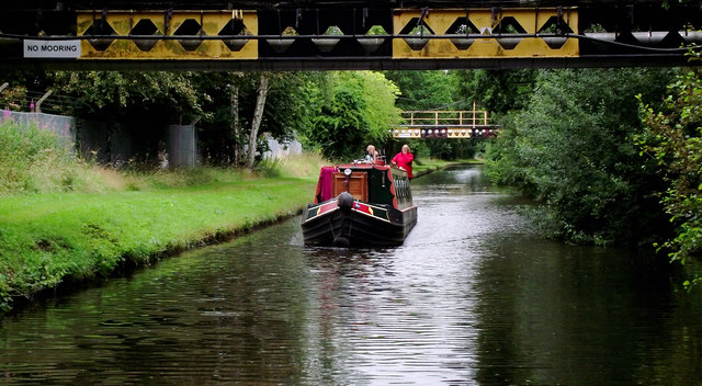
Image: © Roger D Kidd Taken: 28 Jul 2015
Here the canal is crossed by one of two bridges supporting pipes at the main Schenectady (SI Group) chemical works, which is (was) situated on both sides of the canal. The current satellite image shows the whole of the site north-east of the canal has been demolished. I am unsure whether Schenectady still uses the bridges, or even if they still operate on both parts of the site. The Staffordshire and Worcestershire Canal was opened in 1772, engineered by James Brindley. It joins the River Severn at Stourport to the Trent and Mersey Canal at Great Haywood Junction in Staffordshire. There are 43 locks (45 if you don't fancy the deep wide locks at Stourport) and the canal is 46 miles in length.
Images are licensed for reuse under creativecommons.org/licenses/by-sa/2.0
Image Location
Latitude
52.678546
Longitude
-2.123016