Land west of M23
Introduction
The photograph on this page of Land west of M23 by Robin Webster as part of the Geograph project.
The Geograph project started in 2005 with the aim of publishing, organising and preserving representative images for every square kilometre of Great Britain, Ireland and the Isle of Man.

There are currently over 7.5m images from over 14,400 individuals and you can help contribute to the project by visiting https://www.geograph.org.uk
Land west of M23
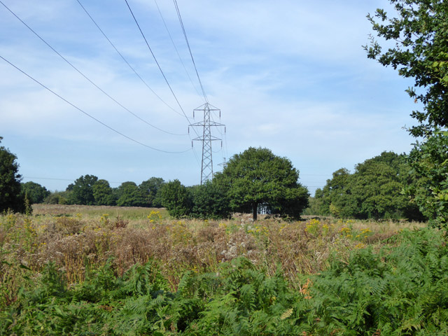
Image: © Robin Webster Taken: 28 Aug 2017
This is part of the Forge Wood East housing development site, but so far untouched. There is what looks like a newish lattice tower hiding behind the tree, but not overtopping it from this angle. Trunking going into the ground suggests it may be where power cabling for the new site goes underground. It lies on the route of a low voltage power line going from left to right, under the obvious high voltage line.
Images are licensed for reuse under creativecommons.org/licenses/by-sa/2.0
Image Location
Latitude
51.139086
Longitude
-0.141005