Denemouth Viaduct, Castle Eden Dene
Introduction
The photograph on this page of Denemouth Viaduct, Castle Eden Dene by Mat Fascione as part of the Geograph project.
The Geograph project started in 2005 with the aim of publishing, organising and preserving representative images for every square kilometre of Great Britain, Ireland and the Isle of Man.

There are currently over 7.5m images from over 14,400 individuals and you can help contribute to the project by visiting https://www.geograph.org.uk
Denemouth Viaduct, Castle Eden Dene
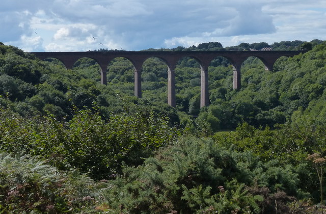
Image: © Mat Fascione Taken: 26 Aug 2017
Opened in 1905, it has ten arches each spanning 60 feet. It carries the railway across Castle Eden Burn.
Images are licensed for reuse under creativecommons.org/licenses/by-sa/2.0
Image Location
Latitude
54.756524
Longitude
-1.300274