Moriah Baptist Chapel
Introduction
The photograph on this page of Moriah Baptist Chapel by Robin Drayton as part of the Geograph project.
The Geograph project started in 2005 with the aim of publishing, organising and preserving representative images for every square kilometre of Great Britain, Ireland and the Isle of Man.

There are currently over 7.5m images from over 14,400 individuals and you can help contribute to the project by visiting https://www.geograph.org.uk
Moriah Baptist Chapel
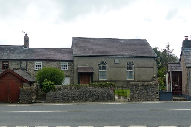
Image: © Robin Drayton Taken: 16 Aug 2017
Meetings started around 1820 with the chapel built in 1829 and then rebuilt in 1888. It was still open in 1998 but now appears to be disused. On the A4120 from Devils Bridge to Aberystwyth.
Images are licensed for reuse under creativecommons.org/licenses/by-sa/2.0
Image Location


Leaflet Map data © OpenStreetMap
Latitude
52.395789
Longitude
-4.030324