Gowk's Den panorama
Introduction
The photograph on this page of Gowk's Den panorama by Keith Proven as part of the Geograph project.
The Geograph project started in 2005 with the aim of publishing, organising and preserving representative images for every square kilometre of Great Britain, Ireland and the Isle of Man.

There are currently over 7.5m images from over 14,400 individuals and you can help contribute to the project by visiting https://www.geograph.org.uk
Gowk's Den panorama
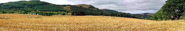
Image: © Keith Proven Taken: 18 Sep 2005
Looking West from the road below West Dron. The wooded slopes (left and centre) form West Dron Hill, with Culteuchar Hill beyond.
Images are licensed for reuse under creativecommons.org/licenses/by-sa/2.0
Image Location
Latitude
56.328267
Longitude
-3.416593